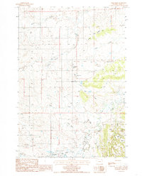
1984 Map of Cedar Ridge
USGS Topo · Published 1985About this map
The Little Missouri River flows through this corner of Crook County, where the high plains transition into a landscape heavily shaped by mid-century mineral extraction. This 1980s-era survey reveals a diverse industrial footprint, particularly the concentration of Uranium Mines and Uranium Mine sites near the eastern boundary along Hulett Creek. The terrain is marked by numerous Bentonite Pits and Shale Pits, indicating the importance of clay and sedimentary rock production to the local economy during this period.
Find a feature on this map
20 named features on this map. Tap any name to fly to it.
Don’t see what you’re looking for? This feature index may not catch every label — zoom into the map to look around manually.
Map Details
Editions of this 1984 Cedar Ridge Map
This is the sole edition of this map. No revisions or reprints were ever made.
Other maps of this area

1905 · Devils Tower
USGS Topo · 1:125,000

1954 · Gillette
USGS Topo · 1:250,000

1955 · Gillette
USGS Topo · 1:250,000

1957 · Oshoto
USGS Topo · 1:62,500

1957 · Cedar Ridge
USGS Topo · 1:62,500

1958 · Gillette
USGS Topo · 1:250,000

1962 · Gillette
USGS Topo · 1:250,000
1972 · Bonnie Reservoir
USGS Topo · 1:24,000
1972 · Brislawn School
USGS Topo · 1:24,000
1972 · Rockypoint
USGS Topo · 1:24,000