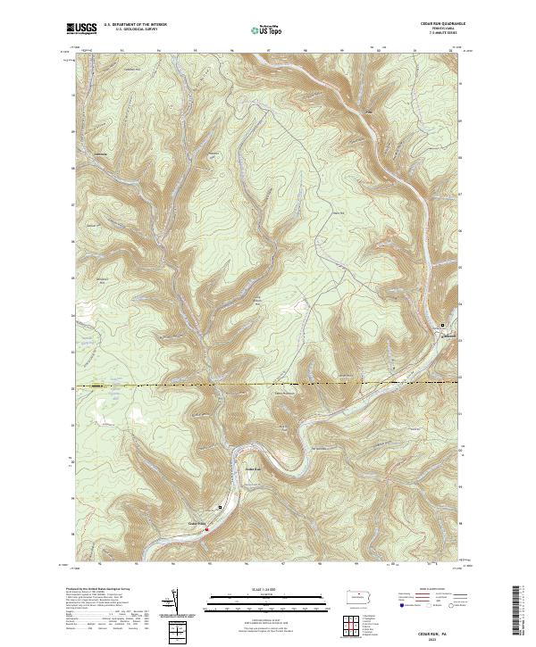
2023 Map of Cedar Run
USGS Topo · Published 2023About this map
Pine Creek Gorge dominates the eastern half of this modern survey, where the waterway carves a deep valley through the high plateau of the Pennsylvania Wilds. The settlement of Cedar Run serves as a focal point at the confluence of its namesake stream and Pine Creek, while the village of Blackwell sits further north near the mouth of Babb Creek. This landscape is defined by the legacy of resource extraction and current conservation, evidenced by the transition from old logging ways like Old Logging Rd to modern recreation routes including the Pine Creek Rail Trl and Mid State Trl. On the western edge, the remote community of Leetonia remains situated among deep hollows like Mill Hollow and Dam Hollow. Local genealogy is anchored by the Cedar Run Cem and Blackwell Cem, preserving the names of the families who settled this challenging terrain.
Find a feature on this map
95 named features on this map. Tap any name to fly to it.
Don’t see what you’re looking for? This feature index may not catch every label — zoom into the map to look around manually.
Map Details
Editions of this 2023 Cedar Run Map
This is the sole edition of this map. No revisions or reprints were ever made.
Other maps of this area

1937 · Waterville
USGS Topo · 1:48,000

1943 · Hyner
USGS Topo · 1:62,500

1943 · Waterville
USGS Topo · 1:62,500

1946 · Tiadaghton
USGS Topo · 1:24,000

1946 · Antrim
USGS Topo · 1:62,500

1946 · Renovo East
USGS Topo · 1:62,500

1946 · Cedar Run
USGS Topo · 1:24,000

1946 · Slate Run
USGS Topo · 1:24,000

1946 · Antrim
USGS Topo · 1:24,000

1946 · Morris
USGS Topo · 1:24,000
Featured Places
- Morris Township, PA
- Blackwell, Morris Township
- Elk Township, PA
- Leetonia, Elk Township
- Pine, Morris Township