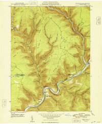
1948 Map of Cedar Run
USGS Topo · Published 1948About this map
The deep Pine Creek gorge dominates this Pennsylvania mountain landscape, carving a winding path between Tioga Co and Lycoming Co. In the late 1940s, small settlements like Cedar Run and Blackwell served as critical points along the Central New York railroad line, which hugs the riverbanks through the tight canyon known as the Gorge. Evidence of early industrial activity is visible in names like Clay Mine Run and Stone Quarry Run, while the remote northern reaches show isolated mountain communities such as Leetonia and Gleason. The map documents a rugged river-and-rail economy where narrow valleys like Babb Creek meet the main waterway. Local genealogy is well-served by landmarks such as the Cedar Run Ch and the Lloyd P O, providing clear reference points for researchers tracing family history in these Pennsylvania hollows.
Find a feature on this map
77 named features on this map. Tap any name to fly to it.
Don’t see what you’re looking for? This feature index may not catch every label — zoom into the map to look around manually.
Map Details
Editions of this 1948 Cedar Run Map
2 editions found
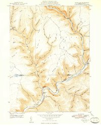
Other maps of this area

1937 · Waterville
USGS Topo · 1:48,000

1943 · Hyner
USGS Topo · 1:62,500

1943 · Waterville
USGS Topo · 1:62,500

1946 · Tiadaghton
USGS Topo · 1:24,000

1946 · Antrim
USGS Topo · 1:62,500

1946 · Renovo East
USGS Topo · 1:62,500

1946 · Cedar Run
USGS Topo · 1:24,000

1946 · Slate Run
USGS Topo · 1:24,000

1946 · Antrim
USGS Topo · 1:24,000

1946 · Morris
USGS Topo · 1:24,000
Featured Places
- Morris Township, PA
- Brown Township, PA
- Cedar Run, Brown Township
- Elk Township, PA
- Cedar Pines, Brown Township