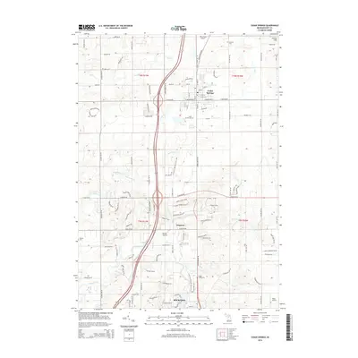
2014 Map of Cedar Springs
USGS Topo · Published 2014About this map
Cedar Springs and the surrounding Kent County countryside are defined by a network of creeks and small settlements in this early 21st-century record. The area is anchored by the Rogue River in the south, which flows through the outskirts of Rockford near the Rogue Pond. This landscape transitions from the concentrated street grids of the primary towns to more dispersed rural development around Edgerton and Porter Hollow. For genealogists, the map preserves the locations of several burial grounds, including the Briggs Family Cem, Punches Cem, and Solon Cem. The presence of Wilds Field Airport and Wells Airport highlights the aviation infrastructure serving these northern Grand Rapids suburbs. The undulating terrain is most pronounced at Cheney Hills in the northeast, while the central corridor is dominated by the modern path of Highway 131 and the Northland Dr NE thoroughfare.
Find a feature on this map
110 named features on this map. Tap any name to fly to it.
Don’t see what you’re looking for? This feature index may not catch every label — zoom into the map to look around manually.
Map Details
Editions of this 2014 Cedar Springs Map
This is the sole edition of this map. No revisions or reprints were ever made.
Other maps of this area

1918 · Cedar Springs
USGS Topo · 1:62,500

1943 · Cedar Springs
USGS Topo · 1:62,500

1954 · Midland
USGS Topo · 1:250,000

1958 · Midland
USGS Topo · 1:250,000

1958 · Sand Lake
USGS Topo · 1:62,500

1959 · Midland
USGS Topo · 1:250,000

1959 · Howard City
USGS Topo · 1:62,500

1966 · Midland
USGS Topo · 1:250,000

1967 · Sparta
USGS Topo · 1:24,000

1967 · Cedar Springs
USGS Topo · 1:24,000