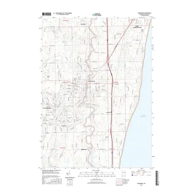
2016 Map of Cedarburg
USGS Topo · Published 2016About this map
The Milwaukee River winds southward through the center of this terrain, anchoring a corridor of industry and settlement between Saukville and Mequon. The river’s historical utility is evident in features such as the Grafton Millpond and Lime Kiln Millpond near Grafton, reflecting the importance of water power and local extraction to the regional economy. To the west, Cedar Creek flows through Cedarburg, where preservation and public spaces like Covered Bridge Fields and the Cedarburg Pond highlight the community's heritage.
Find a feature on this map
177 named features on this map. Tap any name to fly to it.
Don’t see what you’re looking for? This feature index may not catch every label — zoom into the map to look around manually.
Map Details
Editions of this 2016 Cedarburg Map
This is the sole edition of this map. No revisions or reprints were ever made.
Other maps of this area

1892 · Milwaukee
USGS Topo · 1:62,500

1892 · Waukesha
USGS Topo · 1:62,500

1892 · Port Washington
USGS Topo · 1:62,500

1901 · Milwaukee
USGS Topo · 1:62,500

1901 · Waukesha
USGS Topo · 1:62,500

1904 · West Bend
USGS Topo · 1:62,500

1904 · Port Washington
USGS Topo · 1:62,500

1906 · Waukesha
USGS Topo · 1:62,500

1906 · Milwaukee
USGS Topo · 1:62,500

1954 · Milwaukee
USGS Topo · 1:250,000