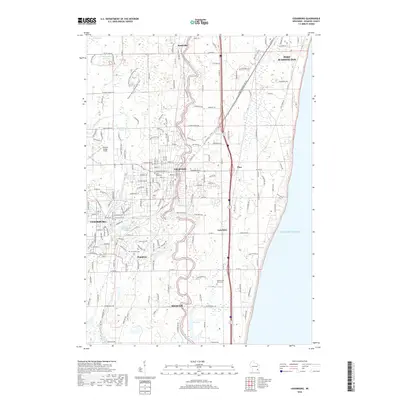
2018 Map of Cedarburg
USGS Topo · Published 2018About this map
The Milwaukee River meanders southward through the heart of Ozaukee County, defining the corridor between Saukville and Mequon. In this 2018 snapshot, the suburban expansion of Grafton and Cedarburg is evident, yet much of the area's early character remains visible through its numerous historic burial grounds. Genealogists can locate several significant sites including Zur Ruhe Cem and the Old Settlers Rest Cem. The landscape transitions from the preserved wetlands of Cedarburg Bog in the north to the industrial and residential developments near Hamilton and Lakefield. The eastern edge is dominated by the dramatic shoreline of Lake Michigan, while inland, the confluence of Cedar Creek and the river provides a focal point for the historic mill-town settlements that first drew people to this region.
Find a feature on this map
186 named features on this map. Tap any name to fly to it.
Don’t see what you’re looking for? This feature index may not catch every label — zoom into the map to look around manually.
Map Details
Editions of this 2018 Cedarburg Map
This is the sole edition of this map. No revisions or reprints were ever made.
Other maps of this area

1892 · Milwaukee
USGS Topo · 1:62,500

1892 · Waukesha
USGS Topo · 1:62,500

1892 · Port Washington
USGS Topo · 1:62,500

1901 · Milwaukee
USGS Topo · 1:62,500

1901 · Waukesha
USGS Topo · 1:62,500

1904 · West Bend
USGS Topo · 1:62,500

1904 · Port Washington
USGS Topo · 1:62,500

1906 · Waukesha
USGS Topo · 1:62,500

1906 · Milwaukee
USGS Topo · 1:62,500

1954 · Milwaukee
USGS Topo · 1:250,000