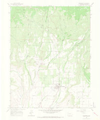
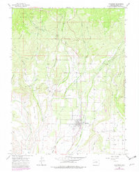
1965 Map of Cedaredge
USGS Topo · Published 1968About this map
Cedaredge serves as the focal point of this Delta County landscape during the mid-1960s, a period marked by an intricate balance between agricultural irrigation and the local mining industry. The town is characterized by its High Sch, Cemetery, and community spaces like the Rodeo Ground. This region's unique geography, situated below the southern edge of the Grand Mesa National Forest, is defined by an extensive network of man-made waterways. Elaborate ditch systems, including the Big Ditch, Alfalfa Ditch, and Granby Ditch, reveal the intensive efforts required to manage water across the local mesas.
Find a feature on this map
42 named features on this map. Tap any name to fly to it.
Don’t see what you’re looking for? This feature index may not catch every label — zoom into the map to look around manually.
Map Details
Editions of this 1965 Cedaredge Map
5 editions found
Other maps of this area

1955 · Grand Mesa
USGS Topo · 1:24,000

1955 · Lazear
USGS Topo · 1:24,000

1955 · Skyway
USGS Topo · 1:24,000

1956 · Montrose
USGS Topo · 1:250,000

1956 · Moab
USGS Topo · 1:250,000

1956 · Grand Junction
USGS Topo · 1:250,000

1957 · Leadville
USGS Topo · 1:250,000

1959 · Grand Junction
USGS Topo · 1:250,000

1959 · Moab
USGS Topo · 1:250,000

1959 · Leadville
USGS Topo · 1:250,000