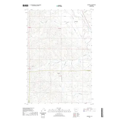
2020 Map of Cedarville
USGS Topo · Published 2020About this map
Cedarville and the winding Chehalis River anchor the northeastern corner of this Pacific Northwest landscape. The terrain is defined by a dense network of timbered ridges and creek valleys, where drainages like Garrard Cr and its S Fork Garrard Cr carve deep into the topography. While much of the land remains a patchwork of forested sections, human activity is concentrated along the river valley and more accessible lowland corridors. The presence of the Kimbrel Farm Airport indicates the role of private aviation in managing these more isolated tracts. A complex web of logging and access roads, including Garrard Creek Rd and Brooklyn Rd, provides a clear view of how the region is traversed between Grays Harbor and Lewis counties. Significant water features such as Williams Cr and Independence Cr illustrate the watershed's drainage pattern toward the primary river artery.
Find a feature on this map
31 named features on this map. Tap any name to fly to it.
Don’t see what you’re looking for? This feature index may not catch every label — zoom into the map to look around manually.
Map Details
Editions of this 2020 Cedarville Map
This is the sole edition of this map. No revisions or reprints were ever made.
Other maps of this area

1941 · Walville
USGS Topo · 1:62,500

1941 · Meskill
USGS Topo · 1:62,500

1941 · Gate
USGS Topo · 1:62,500

1941 · Ford
USGS Topo · 1:62,500

1953 · Hoquiam
USGS Topo · 1:250,000

1953 · Rochester
USGS Topo · 1:62,500

1953 · Pe Ell
USGS Topo · 1:62,500

1953 · Malone
USGS Topo · 1:62,500

1953 · Adna
USGS Topo · 1:62,500

1957 · Hoquiam
USGS Topo · 1:250,000