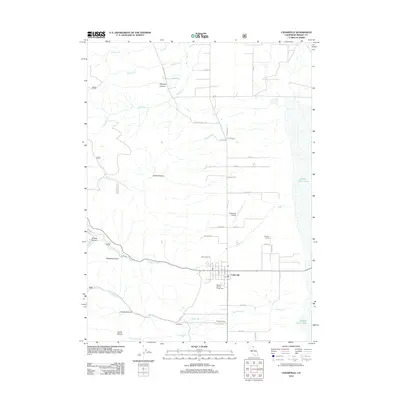
2012 Map of Cedarville
USGS Topo · Published 2012About this map
Cedarville sits at the foot of the Warner Mountains, where the high desert meets the western edge of Middle Alkali Lake. This 2012 survey documents a town defined by its agricultural and civic infrastructure, anchored by the Modoc County Fairground and the Cedarville Airport. The map highlights a series of canyons cutting through the western terrain, including Simpson Canyon, Cooks Canyon, and Shingle Canyon, which channel seasonal water through Cedar Cr and N Deep Cr toward the dry lake bed. For genealogists and local historians, the sheet identifies specific burial sites like Cedarville Cem and the Indian Cem, alongside rural landmarks such as Bunyard Ranch. The street grid of the town center, featuring Garfield St and Center St, shows the concentrated settlement patterns of Surprise Valley.
Find a feature on this map
49 named features on this map. Tap any name to fly to it.
Don’t see what you’re looking for? This feature index may not catch every label — zoom into the map to look around manually.
Map Details
Editions of this 2012 Cedarville Map
This is the sole edition of this map. No revisions or reprints were ever made.
Other maps of this area

1886 · Alturas
USGS Topo · 1:250,000

1892 · Alturas
USGS Topo · 1:250,000

1954 · Alturas
USGS Topo · 1:250,000

1958 · Alturas
USGS Topo · 1:250,000

1962 · Alturas
USGS Topo · 1:250,000

1962 · Davis Creek
USGS Topo · 1:62,500

1962 · Cedarville
USGS Topo · 1:62,500

1963 · Warren Peak
USGS Topo · 1:24,000
1963 · Hansen Island
USGS Topo · 1:24,000

1963 · Shields Creek
USGS Topo · 1:24,000