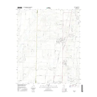
2016 Map of Celina
USGS Topo · Published 2016About this map
Celina serves as the central hub of this 2016 survey, situated along the county line where Denton and Collin counties meet. The landscape is defined by the headwaters of several prominent regional waterways, including Mustang Cr, Little Elm Cr, and Wilson Cr. These stream networks interweave with a grid of rural roads and emerging residential developments, reflecting the area's transition from open ranch land to a growing suburban corridor.
Find a feature on this map
84 named features on this map. Tap any name to fly to it.
Don’t see what you’re looking for? This feature index may not catch every label — zoom into the map to look around manually.
Map Details
Editions of this 2016 Celina Map
This is the sole edition of this map. No revisions or reprints were ever made.
Other maps of this area

1929 · Frisco
USGS Topo · 1:62,500

1929 · McKinney
USGS Topo · 1:62,500

1954 · Sherman
USGS Topo · 1:250,000

1958 · Sherman
USGS Topo · 1:250,000

1960 · Frisco
USGS Topo · 1:24,000

1960 · Celina
USGS Topo · 1:24,000

1960 · Aubrey
USGS Topo · 1:24,000
1960 · Little Elm
USGS Topo · 1:24,000
1960 · McKinney West
USGS Topo · 1:24,000

1961 · Gunter
USGS Topo · 1:24,000