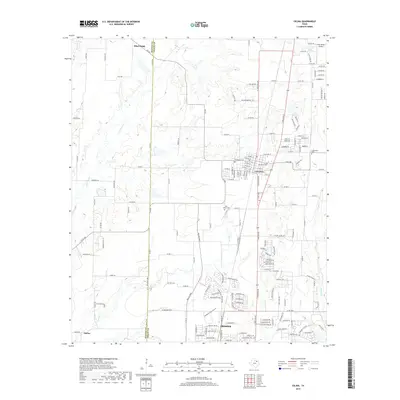
2019 Map of Celina
USGS Topo · Published 2019About this map
Celina and Prosper anchor this 2019 study of the rapidly evolving corridor along the Denton and Collin County line. The map illustrates a landscape in transition, where established rural landmarks like Old Union Cemetery and Old Celina Cemetery now stand alongside modern suburban developments and arterial roads such as FM 455 and W Frontier Pkwy. The drainage patterns of Mustang Creek, Little Elm Creek, and Wilson Creek provide a natural framework for the terrain, while the northern edge of the map reaches toward Pilot Point. Genealogists will find particular value in the documentation of local burial grounds and the small settlement of Parvin, providing a clear record of the area's heritage amidst twenty-first-century expansion.
Find a feature on this map
159 named features on this map. Tap any name to fly to it.
Don’t see what you’re looking for? This feature index may not catch every label — zoom into the map to look around manually.
Map Details
Editions of this 2019 Celina Map
This is the sole edition of this map. No revisions or reprints were ever made.
Other maps of this area

1929 · Frisco
USGS Topo · 1:62,500

1929 · McKinney
USGS Topo · 1:62,500

1954 · Sherman
USGS Topo · 1:250,000

1958 · Sherman
USGS Topo · 1:250,000

1960 · Frisco
USGS Topo · 1:24,000

1960 · Celina
USGS Topo · 1:24,000

1960 · Aubrey
USGS Topo · 1:24,000
1960 · Little Elm
USGS Topo · 1:24,000
1960 · McKinney West
USGS Topo · 1:24,000

1961 · Gunter
USGS Topo · 1:24,000