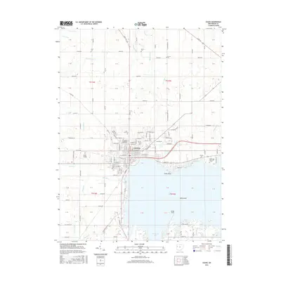
2016 Map of Celina
USGS Topo · Published 2016About this map
Celina serves as the hub of this Mercer County landscape, situated on the northern banks of Grand Lake. The map reveals a high density of local history markers, including numerous burial grounds like Immaculate Conception Catholic Cem, North Grove Cem, and Petrie Cem. The western shoreline is developed near Harbor Point, while the southeastern corner is dominated by the waters of Montezuma Bay and Prairie Creek. The presence of the Wright State Univ - Lake Campus on the eastern edge of the city signifies its role as a regional educational center. To the north, the land is defined by a rigorous grid of section lines and drainage features such as Wenskes Ditch and Bberdorfer Ditch, reflecting the managed agricultural environment of the mid-2010s.
Find a feature on this map
143 named features on this map. Tap any name to fly to it.
Don’t see what you’re looking for? This feature index may not catch every label — zoom into the map to look around manually.
Map Details
Editions of this 2016 Celina Map
This is the sole edition of this map. No revisions or reprints were ever made.
Other maps of this area

1908 · St. Henry
USGS Topo · 1:62,500

1909 · Loramie
USGS Topo · 1:62,500

1911 · Loramie
USGS Topo · 1:62,500

1911 · Spencerville
USGS Topo · 1:62,500

1914 · Celina
USGS Topo · 1:62,500

1944 · Loramie
USGS Topo · 1:62,500

1944 · Celina
USGS Topo · 1:62,500

1944 · Spencerville
USGS Topo · 1:62,500

1953 · Muncie
USGS Topo · 1:250,000

1956 · Muncie
USGS Topo · 1:250,000