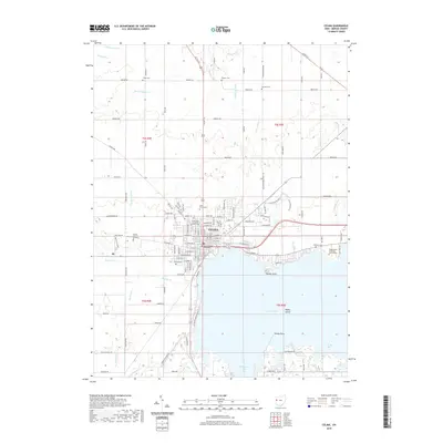
2019 Map of Celina
USGS Topo · Published 2019About this map
Celina and the northern shores of Grand Lake dominate this survey, centered on the Mercer County Courthouse and the city's grid. The landscape reveals a dense network of water management features, such as Dennison Ditch, Wenskes Ditch, and Blierdofer Ditch, which drain the surrounding agricultural lands toward the lake and local tributaries like Beaver Cr. This managed hydrology is characteristic of the region's development, supporting both the urban center and the outlying farmsteads along routes like Us Rte 127 and Us Rte 33.
Find a feature on this map
126 named features on this map. Tap any name to fly to it.
Don’t see what you’re looking for? This feature index may not catch every label — zoom into the map to look around manually.
Map Details
Editions of this 2019 Celina Map
This is the sole edition of this map. No revisions or reprints were ever made.
Other maps of this area

1908 · St. Henry
USGS Topo · 1:62,500

1909 · Loramie
USGS Topo · 1:62,500

1911 · Loramie
USGS Topo · 1:62,500

1911 · Spencerville
USGS Topo · 1:62,500

1914 · Celina
USGS Topo · 1:62,500

1944 · Loramie
USGS Topo · 1:62,500

1944 · Celina
USGS Topo · 1:62,500

1944 · Spencerville
USGS Topo · 1:62,500

1953 · Muncie
USGS Topo · 1:250,000

1956 · Muncie
USGS Topo · 1:250,000