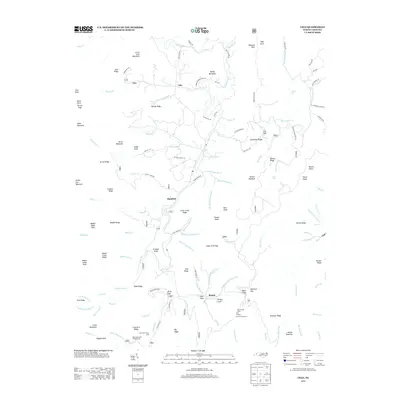
2013 Map of Celo
USGS Topo · Published 2013About this map
Celo and Hamrick sit along the winding valley of the S Toe River, a landscape defined by sharp elevation changes and high mountain peaks. The 2013 topography reveals the concentrated settlement patterns in the gaps and coves, including Sugar Cove and Burgin Cove near Busick. This map illustrates the intersection of recreation and geography, featuring the Black Mountain Campground and the Lost Cove Picnic Area alongside numerous vertical landmarks like Celo Knob and Percys Peak. The abundance of water features, such as Roaring Spout Falls, Crabtree Falls, and Murphy Falls, highlights the steep drainage patterns from the surrounding ridges into the river valley. Notable engineering is also visible near Busick, where the Twin Tunnels carry traffic beneath the ridges of the Blue Ridge Mountains.
Find a feature on this map
132 named features on this map. Tap any name to fly to it.
Don’t see what you’re looking for? This feature index may not catch every label — zoom into the map to look around manually.
Map Details
Editions of this 2013 Celo Map
This is the sole edition of this map. No revisions or reprints were ever made.
Other maps of this area

1900 · Mount Mitchell
USGS Topo · 1:125,000

1902 · Mount Mitchell
USGS Topo · 1:125,000

1934 · Micaville
USGS Topo · 1:24,000

1934 · Spruce Pine
USGS Topo · 1:24,000

1934 · Parts Of Celo And Black Brothers
USGS Topo · 1:24,000

1934 · Parts Of Old Fort and Montreat
USGS Topo · 1:24,000

1935 · Montreat
USGS Topo · 1:24,000

1935 · Black Brothers
USGS Topo · 1:24,000

1935 · Burnsville
USGS Topo · 1:24,000
1939 · Burnsville
USGS Topo · 1:24,000