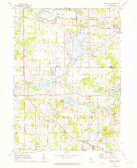
1971 Map of Cement City
USGS Topo · Published 1973About this map
Clark Lake and Columbia Lake anchor a landscape defined by glacial topography and early 1970s lakeside settlement. The area around Cement City and Brooklyn is crisscrossed by established transportation routes, including the Penn Central line and an older railroad grade near Goose Creek. Significant local landmarks like St Rita Ch, Sanford Cem, and the Columbia Central High Sch provide essential geographic markers for genealogical research. The southern portion of the sheet features prominent rises at Prospect Hill and Irish Hill, overlooking the intricate wetland systems of the Onsted State Wildlife Management Area. Numerous gravel pits and a lone Oil Well point to the local extraction industries of the era, while recreational features like the Landing Field, golf courses, and various campgrounds suggest the region's mid-century transition into a prominent seasonal destination.
Find a feature on this map
69 named features on this map. Tap any name to fly to it.
Don’t see what you’re looking for? This feature index may not catch every label — zoom into the map to look around manually.
Map Details
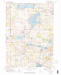
Editions of this 1971 Cement City Map
2 editions found
Other maps of this area

1935 · Jackson
USGS Topo · 1:48,000

1939 · Jackson
USGS Topo · 1:62,500

1948 · Manchester
USGS Topo · 1:62,500

1949 · Manchester
USGS Topo · 1:62,500

1953 · Fort Wayne
USGS Topo · 1:250,000

1956 · Fort Wayne
USGS Topo · 1:250,000

1958 · Grand Rapids
USGS Topo · 1:250,000

1961 · Grand Rapids
USGS Topo · 1:250,000

1962 · Grand Rapids
USGS Topo · 1:250,000
1962 · Wheatland
USGS Topo · 1:24,000