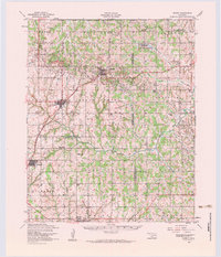
1956 Map of Cement
USGS Topo · Published 1984About this map
The town of Cement and the nearby Oil Refinery at Cyril anchor this mid-century portrait of Caddo and Comanche counties. The landscape is defined by the St Louis - San Francisco RR corridor, which connects the primary settlements and supported the regional petroleum and agricultural economy. The survey highlights several culturally significant landmarks, including the Cyril Indian Mission and the Little Washita Indian Church, reflecting the area's indigenous heritage. North of the Washita River, the North Cement Hills overlook Lake Louis Burtschi and its surrounding state game reservation. For genealogists and local historians, the map identifies specific rural institutions such as the Laverty Cemetery, Pioneer School, and Mount View, providing a clear record of the community's footprint before later 20th-century developments reshaped the rural sections of these counties.
Find a feature on this map
45 named features on this map. Tap any name to fly to it.
Don’t see what you’re looking for? This feature index may not catch every label — zoom into the map to look around manually.
Map Details
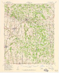
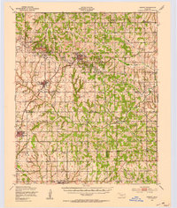
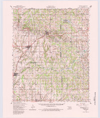
Editions of this 1956 Cement Map
3 editions found