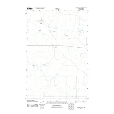
2011 Map of Cemetery Coulee
USGS Topo · Published 2011About this map
The arid drainage systems of McCone County define this landscape, where Cemetery Coulee and Soda Creek carve through the high plains. Water management dominates the northern half of the map, evidenced by a series of earthen structures including Hannaland Number 3 Dam, Hannaland Number 4 Dam, and several others in the Hannaland sequence. These features suggest a concentrated effort to capture seasonal runoff for livestock or local irrigation in a region where water is a precious resource.
Find a feature on this map
13 named features on this map. Tap any name to fly to it.
Don’t see what you’re looking for? This feature index may not catch every label — zoom into the map to look around manually.
Map Details
Editions of this 2011 Cemetery Coulee Map
This is the sole edition of this map. No revisions or reprints were ever made.
Other maps of this area

1954 · Jordan
USGS Topo · 1:250,000

1954 · Glendive
USGS Topo · 1:250,000

1956 · Jordan
USGS Topo · 1:250,000

1957 · Glendive
USGS Topo · 1:250,000

1958 · Jordan
USGS Topo · 1:250,000

1958 · Glendive
USGS Topo · 1:250,000

1964 · Jordan
USGS Topo · 1:250,000

1965 · Hedstrom Lake
USGS Topo · 1:24,000

1965 · Hedstrom Lake NW
USGS Topo · 1:24,000
1965 · Berry School
USGS Topo · 1:24,000