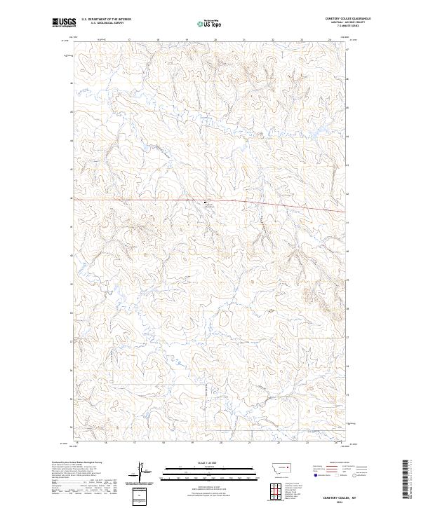
2024 Map of Cemetery Coulee
USGS Topo · Published 2024About this map
Haglunds Ritchie Cem serves as a quiet local landmark within this expansive McCone County landscape, situated on a rise between the drainage basins of Soda Creek and Skull Creek. The terrain is defined by the significant incision of Cemetery Coulee, which winds through the central sections of the quadrangle. This area of eastern Montana retains a distinct rural character, where the township and range grid lines of T18N R44E and T18N R45E dictate the movement of local traffic along routes like Skull Creek Rd and Wilbur Rd. The drainage patterns of these seasonal creeks illustrate a landscape of deep coulees and ridges typical of the Missouri Plateau, offering a clear record of the area's hydrology and land-use divisions for researchers and local historians alike.
Find a feature on this map
12 named features on this map. Tap any name to fly to it.
Don’t see what you’re looking for? This feature index may not catch every label — zoom into the map to look around manually.
Map Details
Editions of this 2024 Cemetery Coulee Map
This is the sole edition of this map. No revisions or reprints were ever made.
Other maps of this area

1954 · Jordan
USGS Topo · 1:250,000

1954 · Glendive
USGS Topo · 1:250,000

1956 · Jordan
USGS Topo · 1:250,000

1957 · Glendive
USGS Topo · 1:250,000

1958 · Jordan
USGS Topo · 1:250,000

1958 · Glendive
USGS Topo · 1:250,000

1964 · Jordan
USGS Topo · 1:250,000

1965 · Hedstrom Lake
USGS Topo · 1:24,000

1965 · Hedstrom Lake NW
USGS Topo · 1:24,000
1965 · Berry School
USGS Topo · 1:24,000