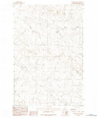
1983 Map of Cemetery Coulee
USGS Topo · Published 1983About this map
Cemetery Coulee cuts a distinct path through this section of McCone County, Montana, as it was recorded by the U.S. Geological Survey in the early 1980s. The landscape is defined by the drainage networks of seasonal waterways, including the winding course of Soda Creek in the north and the expansive reach of Skull Creek in the south. This provisional study captures the area's intricate topography through detailed contour mapping, reflecting the complex erosion patterns typical of this high plains region. The absence of major settlements emphasizes the rural, ranch-oriented character of the territory, where terrain features like these coulees and creeks serve as the primary landmarks for navigating the open country.
Find a feature on this map
3 named features on this map. Tap any name to fly to it.
Don’t see what you’re looking for? This feature index may not catch every label — zoom into the map to look around manually.
Map Details
Editions of this 1983 Cemetery Coulee Map
This is the sole edition of this map. No revisions or reprints were ever made.
Other maps of this area

1954 · Jordan
USGS Topo · 1:250,000

1954 · Glendive
USGS Topo · 1:250,000

1956 · Jordan
USGS Topo · 1:250,000

1957 · Glendive
USGS Topo · 1:250,000

1958 · Jordan
USGS Topo · 1:250,000

1958 · Glendive
USGS Topo · 1:250,000

1964 · Jordan
USGS Topo · 1:250,000

1965 · Hedstrom Lake
USGS Topo · 1:24,000

1965 · Hedstrom Lake NW
USGS Topo · 1:24,000
1965 · Berry School
USGS Topo · 1:24,000