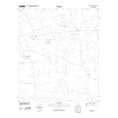
2010 Map of Center City
USGS Topo · Published 2010About this map
Center City serves as the focal point of this Central Texas landscape, where the rural road network converges near the Center City Cemetery. The terrain is defined by a complex drainage system featuring Mustang Creek, North Bennett Creek, and South Bennett Creek, which feed into various man-made water bodies. Significant water management efforts are evident through the presence of the Soil Conservation Service Site 1 Reservoir and Soil Conservation Service Site 2 Reservoir, alongside Kemp Lake and the Shelton Lake Dam. These reservoirs and dams reflect the 20th-century focus on soil conservation and flood control in the region. The topography is further punctuated by natural passes such as Barr Gap and Russell Gap, providing passage through the rising elevations. This map documents a quiet agricultural region where cattle ranching and land management have shaped the local geography, connected by a web of routes like Ranch Rd 572 and FM Rd 250.
Find a feature on this map
40 named features on this map. Tap any name to fly to it.
Don’t see what you’re looking for? This feature index may not catch every label — zoom into the map to look around manually.
Map Details
Editions of this 2010 Center City Map
This is the sole edition of this map. No revisions or reprints were ever made.
Other maps of this area

1885 · San Saba
USGS Topo · 1:125,000

1887 · Lampasas
USGS Topo · 1:125,000

1888 · Hamilton
USGS Topo · 1:125,000

1889 · Brownwood
USGS Topo · 1:125,000

1894 · Hamilton
USGS Topo · 1:125,000

1894 · Lampasas
USGS Topo · 1:125,000

1894 · Brownwood
USGS Topo · 1:125,000

1894 · San Saba
USGS Topo · 1:125,000

1925 · San Saba 1-d
USGS Topo · 1:48,000

1928 · Goldthwaite
USGS Topo · 1:62,500