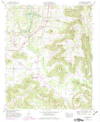
1947 Map of Center Grove
USGS Topo · Published 1983About this map
Wheeler Reservoir defines the northern edge of this landscape, its controlled waters reaching into the mouth of Cotaco Creek. The terrain is characterized by a series of prominent rises and coves, including Brindley Mountain and Georgia Mountain, which separate the agricultural valley floors from the higher ridges. Small rural communities like Woodland Mills, Florette, and Lyantown are connected by a network of local roads that snake through the gaps and around features like Potato Hill and Bean Mountain.
Find a feature on this map
81 named features on this map. Tap any name to fly to it.
Don’t see what you’re looking for? This feature index may not catch every label — zoom into the map to look around manually.
Map Details
Editions of this 1947 Center Grove Map
3 editions found
Other maps of this area

1888 · Cullman
USGS Topo · 1:125,000

1888 · Huntsville
USGS Topo · 1:125,000

1892 · Cullman
USGS Topo · 1:125,000

1892 · Huntsville
USGS Topo · 1:125,000

1936 · Triana
USGS Topo · 1:24,000

1936 · Hulaco
USGS Topo · 1:24,000

1936 · Eva
USGS Topo · 1:24,000

1936 · Somerville
USGS Topo · 1:24,000

1936 · Lawrence Cove
USGS Topo · 1:24,000

1936 · Center Grove
USGS Topo · 1:24,000