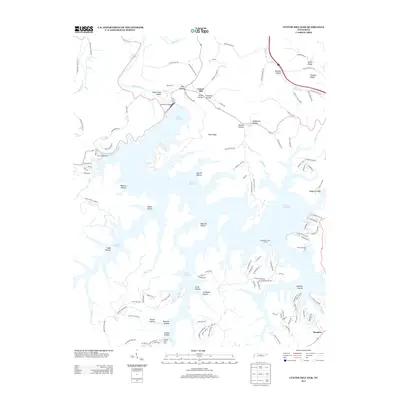
2013 Map of Center Hill Dam
USGS Topo · Published 2013About this map
Center Hill Dam controls the flow of the Caney Fork river in this 2013 survey, where the massive impoundment of Center Hill Lake creates a complex landscape of winding fingers and deep hollows. The settlement of Laurel Hill sits near the dam, adjacent to the recreational grounds of Edgar Evans State Park. The topography is defined by narrow ridges and family-named hollows, such as Wallace Hollow and Stillhouse Hollow, reflecting the rural habitation patterns of DeKalb County. The map details a transition from the structured recreational areas like Cove Hollow Dock and the Atnip Bluff Cabin Colony to the more dispersed communities at Buckner. Numerous rural routes like Old Buffalo Valley Rd and Temperance Valley Rd thread through the terrain, connecting isolated homesteads to the river system.
Find a feature on this map
128 named features on this map. Tap any name to fly to it.
Don’t see what you’re looking for? This feature index may not catch every label — zoom into the map to look around manually.
Map Details
Editions of this 2013 Center Hill Dam Map
This is the sole edition of this map. No revisions or reprints were ever made.
Other maps of this area

1893 · Mc Minnville
USGS Topo · 1:125,000

1895 · Mc Minnville
USGS Topo · 1:125,000

1928 · Gordonsville
USGS Topo · 1:62,500

1942 · Statesville
USGS Topo · 1:100,000

1943 · Cookeville
USGS Topo · 1:100,000

1944 · Cookeville
USGS Topo · 1:100,000

1953 · Chattanooga
USGS Topo · 1:250,000

1955 · Baxter
USGS Topo · 1:24,000

1956 · Silver Point
USGS Topo · 1:24,000

1956 · Corbin
USGS Topo · 1:250,000