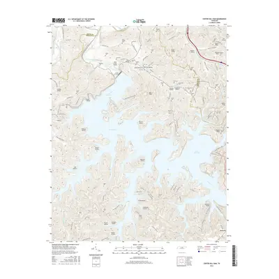
2016 Map of Center Hill Dam
USGS Topo · Published 2016About this map
Caney Fork and the waters of Center Hill Lake dominate this landscape where DeKalb, Smith, and Putnam counties meet. The Center Hill Dam anchors the geography, creating a complex shoreline of deep inlets and ridges such as Moss Ridge and Tucker Ridge. The map reveals a densely settled rural history preserved in its cemeteries, including Mollie League Cem and Moccasin Bluff Cem. Numerous hollows like Stillhouse Hollow, Wildcat Hollow, and Happy Hollow suggest a terrain deeply carved by water, where local life historically concentrated along the lower elevations. The southern portion of the sheet near Buckner shows a network of family-named landmarks and winding roads like Kingdom Rd and Old Buffalo Valley Rd that trace the intricate topography of the Highland Rim.
Find a feature on this map
129 named features on this map. Tap any name to fly to it.
Don’t see what you’re looking for? This feature index may not catch every label — zoom into the map to look around manually.
Map Details
Editions of this 2016 Center Hill Dam Map
This is the sole edition of this map. No revisions or reprints were ever made.
Other maps of this area

1893 · Mc Minnville
USGS Topo · 1:125,000

1895 · Mc Minnville
USGS Topo · 1:125,000

1928 · Gordonsville
USGS Topo · 1:62,500

1942 · Statesville
USGS Topo · 1:100,000

1943 · Cookeville
USGS Topo · 1:100,000

1944 · Cookeville
USGS Topo · 1:100,000

1953 · Chattanooga
USGS Topo · 1:250,000

1955 · Baxter
USGS Topo · 1:24,000

1956 · Silver Point
USGS Topo · 1:24,000

1956 · Corbin
USGS Topo · 1:250,000