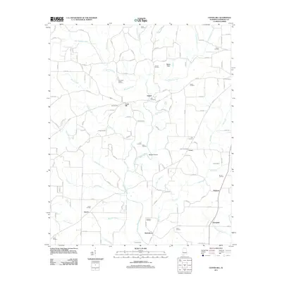
2011 Map of Center Hill
USGS Topo · Published 2011About this map
Bluewater Creek and its many tributaries, including Possum Creek and Hurricane Creek, define the rural landscape of northern Lauderdale County in this early 21st-century study. The area is characterized by a high density of family-named burial grounds and small community clusters, suggesting a deeply rooted local history tied to the land. Settlements such as Arkdell, Sweet Gum, and Center Hill serve as local hubs, while the Comer Post Office stands as a focal point for the surrounding homesteads.
Find a feature on this map
145 named features on this map. Tap any name to fly to it.
Don’t see what you’re looking for? This feature index may not catch every label — zoom into the map to look around manually.
Map Details
Editions of this 2011 Center Hill Map
This is the sole edition of this map. No revisions or reprints were ever made.
Other maps of this area
1905 · Waynesboro
USGS Topo · 1:125,000

1914 · Rogersville
USGS Topo · 1:48,000

1914 · Muscle Shoals
USGS Topo · 1:48,000

1916 · Muscle Shoals
USGS Topo · 1:62,500

1916 · Rogersville
USGS Topo · 1:62,500
1936 · Thorntontown
USGS Topo · 1:24,000
1936 · Lexington
USGS Topo · 1:24,000
1936 · Loretto
USGS Topo · 1:24,000
1936 · Pruitton
USGS Topo · 1:24,000
1936 · Wheeler Dam
USGS Topo · 1:24,000