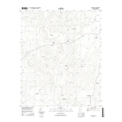
2014 Map of Center Hill
USGS Topo · Published 2014About this map
Lexington and Center Hill anchor this rural landscape in Lauderdale County, where the topography is defined by the winding course of Bluewater Creek and its many tributaries. The area is dense with family-named burial grounds, providing a significant resource for genealogical research with sites such as Richardson Chapel Cem, Grissom Cem, and Scott Cem scattered across the uplands. This 2014 survey documents the enduring settlement patterns of northern Alabama, including small communities like Sweet Gum, Arkdell, and Antioch. Natural water sources are prevalent throughout the region, from Needmore Spring in the northeast to the Posehill Springs near the center of the sheet. These springs and branches, including Shakerag Br and Hurricane Cr, have long influenced the placement of farms and homesteads along the network of county roads that crisscross the terrain between Al-64.
Find a feature on this map
134 named features on this map. Tap any name to fly to it.
Don’t see what you’re looking for? This feature index may not catch every label — zoom into the map to look around manually.
Map Details
Editions of this 2014 Center Hill Map
This is the sole edition of this map. No revisions or reprints were ever made.
Other maps of this area

1905 · Waynesboro
USGS Topo · 1:125,000

1914 · Rogersville
USGS Topo · 1:48,000

1914 · Muscle Shoals
USGS Topo · 1:48,000

1916 · Muscle Shoals
USGS Topo · 1:62,500

1916 · Rogersville
USGS Topo · 1:62,500

1936 · Thorntontown
USGS Topo · 1:24,000

1936 · Lexington
USGS Topo · 1:24,000

1936 · Loretto
USGS Topo · 1:24,000

1936 · Pruitton
USGS Topo · 1:24,000

1936 · Wheeler Dam
USGS Topo · 1:24,000