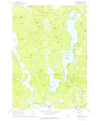
1963 Map of Center Lovell
USGS Topo · Published 1965About this map
The glacial waters of Kezar Lake dominate this Oxford County landscape, divided into the Upper Bay, Middle Bay, and Lower Bay. Along its shores, mid-century recreational life is evident at Camp Mudjekeewis, Camp Agawam, and the Golf Course near the settlement of Lovell. To the west, the terrain rises into the White Mountain National Forest, where summits like Adams Mtn and Deer Hill overlook a network of seasonal watercourses and cemeteries that mark the area's early farmsteads, including the Fox Cem, Lord Cem, and Smith Cem.
Find a feature on this map
88 named features on this map. Tap any name to fly to it.
Don’t see what you’re looking for? This feature index may not catch every label — zoom into the map to look around manually.
Map Details
Editions of this 1963 Center Lovell Map
2 editions found
Other maps of this area

1893 · Gorham
USGS Topo · 1:62,500

1894 · North Conway
USGS Topo · 1:62,500

1896 · North Conway
USGS Topo · 1:62,500

1896 · Gorham
USGS Topo · 1:62,500

1909 · Fryeburg
USGS Topo · 1:62,500

1911 · Fryeburg
USGS Topo · 1:62,500

1914 · Bethel
USGS Topo · 1:62,500

1937 · Gorham
USGS Topo · 1:48,000

1940 · Bethel
USGS Topo · 1:62,500

1941 · Bethel
USGS Topo · 1:62,500