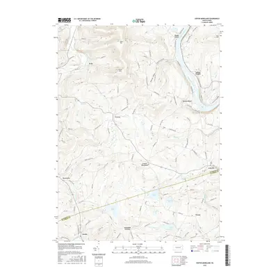
2016 Map of Center Moreland
USGS Topo · Published 2016About this map
The Susquehanna River winds through the northeast corner of this terrain, where the settlement of South Eaton and the crossing at Whites Ferry Rd anchor the riverfront geography. Further inland, the landscape is defined by the high elevations of Miller Mtn and Shaver Mtn, overlooking a network of agricultural valleys and small crossroads communities. Center Moreland sits as a central hub, connected by a web of local routes like Schoolhouse Rd and Orchard Hill Rd.
Find a feature on this map
104 named features on this map. Tap any name to fly to it.
Don’t see what you’re looking for? This feature index may not catch every label — zoom into the map to look around manually.
Map Details
Editions of this 2016 Center Moreland Map
This is the sole edition of this map. No revisions or reprints were ever made.
Other maps of this area

1891 · Harveys Lake
USGS Topo · 1:62,500

1893 · Harvey Lake
USGS Topo · 1:62,500

1893 · Pittston
USGS Topo · 1:62,500

1943 · Scranton
USGS Topo · 1:125,000

1945 · Meshoppen
USGS Topo · 1:62,500

1945 · Meshoppen
USGS Topo · 1:24,000

1946 · Tunkhannock
USGS Topo · 1:62,500

1946 · Kingston
USGS Topo · 1:24,000

1946 · Harveys Lake
USGS Topo · 1:24,000

1946 · Noxen
USGS Topo · 1:24,000
Featured Places
- Dallas Township, PA
- Falls Township, PA
- Orange, Franklin Township
- Kunkle, Dallas Township
- Lockville, Exeter Township