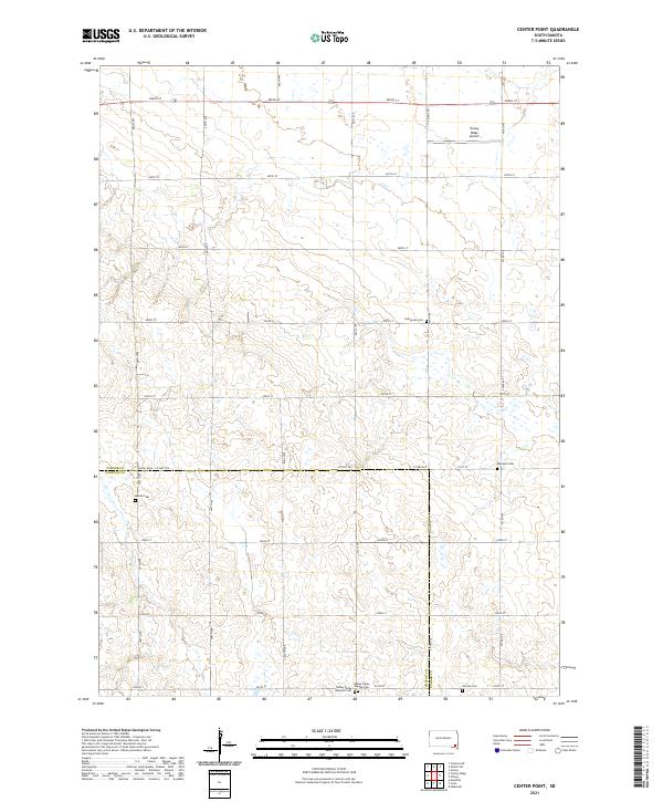
2021 Map of Center Point
USGS Topo · Published 2021About this map
Turkey Cr winds through the rural landscape of the Turner and Yankton county line, anchoring a region defined by its long-standing agricultural roots and pioneer-era church sites. This mapping reveals a high density of early burial grounds, often associated with specific immigrant congregations, such as Turkey-Valley Lutheran Cem and Turkey Valley Baptist Cem. These sites, along with Evergreen Cem and Bethania Cem, provide essential anchor points for genealogical research in this part of South Dakota. The topography is marked by the presence of Turkey Ridge Airport in the northern reaches, while the section-line road grid, including Co Hwy 365 and 290th St, organizes the territory into the traditional checkerboard of the Great Plains homestead system.
Find a feature on this map
26 named features on this map. Tap any name to fly to it.
Don’t see what you’re looking for? This feature index may not catch every label — zoom into the map to look around manually.
Map Details
Editions of this 2021 Center Point Map
This is the sole edition of this map. No revisions or reprints were ever made.
Other maps of this area

1898 · Parker
USGS Topo · 1:125,000

1955 · Sioux Falls
USGS Topo · 1:250,000

1957 · Mayfield
USGS Topo · 1:24,000

1958 · Sioux Falls
USGS Topo · 1:250,000
1968 · Hurley
USGS Topo · 1:24,000

1968 · Parker SW
USGS Topo · 1:24,000
1968 · Wakonda
USGS Topo · 1:24,000
1968 · Viborg
USGS Topo · 1:24,000

1970 · Turkey Ridge
USGS Topo · 1:24,000

1970 · Freeman SE
USGS Topo · 1:24,000
Featured Places
- Turkey Valley Township, SD
- Spring Valley Township, SD
- Daneville Township, SD
- Swan Lake Township, SD
- Yankton County, SD