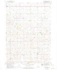
1970 Map of Center Point
USGS Topo · Published 1972About this map
Center Point sits along the southern border of Turner County in this 1970 snapshot of the South Dakota prairie. The landscape is defined by the broad sweeps of Spring Valley and Turkey Valley, where small rural schoolhouses like Norris School, Spring Valley School, and Sletten School served a dispersed farming population. This survey was conducted just as these small educational centers were becoming relics of a past era of local administration.
Find a feature on this map
17 named features on this map. Tap any name to fly to it.
Don’t see what you’re looking for? This feature index may not catch every label — zoom into the map to look around manually.
Map Details
Editions of this 1970 Center Point Map
This is the sole edition of this map. No revisions or reprints were ever made.
Other maps of this area

1898 · Parker
USGS Topo · 1:125,000

1955 · Sioux Falls
USGS Topo · 1:250,000

1957 · Mayfield
USGS Topo · 1:24,000

1958 · Sioux Falls
USGS Topo · 1:250,000
1968 · Hurley
USGS Topo · 1:24,000

1968 · Parker SW
USGS Topo · 1:24,000
1968 · Wakonda
USGS Topo · 1:24,000
1968 · Viborg
USGS Topo · 1:24,000

1970 · Turkey Ridge
USGS Topo · 1:24,000

1970 · Freeman SE
USGS Topo · 1:24,000
Featured Places
- Daneville Township, SD
- Turkey Valley Township, SD
- Swan Lake Township, SD
- Spring Valley Township, SD
- Yankton County, SD