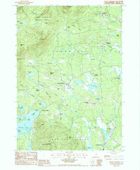
1987 Map of Center Sandwich
USGS Topo · Published 1987About this map
Center Sandwich serves as the focal point of this Carroll County landscape during the late twentieth century, situated at the edge of the White Mountain National Forest. The map illustrates a rural New England community where local geography is defined by family-named landmarks like Burley Hill, Watson Ledge, and Wentworth Hill. Significant water bodies including Squam Lake and Bearcamp Pond provide a clear view of the region's shoreline development and recreational character, noted by features such as Sandwich Landing and Camp Hale. Higher elevations to the north are dominated by Young Mountain and the Sandwich Wilderness Area, while the Red Hill State Lookout Tower stands as a prominent observation point to the south. Small crossroads settlements like Chicks Corner and North Sandwich are linked by a network of brooks and rivers, such as the Bearcamp River and Cold River, which have historically shaped the settlement patterns of the township.
Find a feature on this map
60 named features on this map. Tap any name to fly to it.
Don’t see what you’re looking for? This feature index may not catch every label — zoom into the map to look around manually.
Map Details
Editions of this 1987 Center Sandwich Map
2 editions found
Other maps of this area

1909 · Winnepesaukee
USGS Topo · 1:62,500

1925 · Holderness
USGS Topo · 1:62,500

1927 · Holderness
USGS Topo · 1:62,500

1928 · Plymouth
USGS Topo · 1:62,500

1931 · Plymouth
USGS Topo · 1:62,500

1931 · Mt. Chocorua
USGS Topo · 1:62,500

1949 · Portland
USGS Topo · 1:250,000

1956 · Winnipesaukee
USGS Topo · 1:62,500

1956 · Holderness
USGS Topo · 1:62,500

1956 · Portland
USGS Topo · 1:250,000
Featured Places
- Moultonborough, NH
- Sandwich, NH
- Browns Point, Moultonborough
- Sandwich Landing, Sandwich
- Chicks Corner, Sandwich