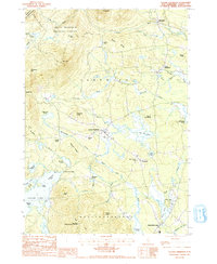
1987 Map of Center Sandwich
USGS Topo · Published 1987About this map
Center Sandwich sits as the central hub of this 1980s landscape, where the transition from the high peaks of the White Mountain National Forest to the northern reaches of Squam Lake is clearly documented. The map captures the area before modern development intensified, showing traditional settlements like North Sandwich and Whiteface connected by a network of brooks and ridges. Notable terrain features such as Mt Israel and the Red Hill State Lookout Tower anchor the topography, while the southern portion of the sheet transitions into the township of Moultonborough.
Find a feature on this map
61 named features on this map. Tap any name to fly to it.
Don’t see what you’re looking for? This feature index may not catch every label — zoom into the map to look around manually.
Map Details
Editions of this 1987 Center Sandwich Map
2 editions found
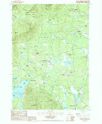
Other maps of this area

1909 · Winnepesaukee
USGS Topo · 1:62,500

1925 · Holderness
USGS Topo · 1:62,500

1927 · Holderness
USGS Topo · 1:62,500

1928 · Plymouth
USGS Topo · 1:62,500

1931 · Plymouth
USGS Topo · 1:62,500

1931 · Mt. Chocorua
USGS Topo · 1:62,500

1949 · Portland
USGS Topo · 1:250,000

1956 · Winnipesaukee
USGS Topo · 1:62,500

1956 · Holderness
USGS Topo · 1:62,500

1956 · Portland
USGS Topo · 1:250,000
Featured Places
- Moultonborough, NH
- Sandwich, NH
- Browns Point, Moultonborough
- Sandwich Landing, Sandwich
- Chicks Corner, Sandwich