2024 Map of Centerton
USGS Topo · Published 2024About this map
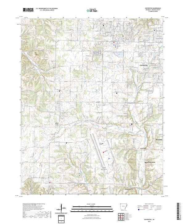
Centerton sits at the heart of this contemporary landscape in Benton County, a region defined by its transition from agricultural roots to a modern transportation and residential hub. The expansive Northwest Arkansas National Airport dominates the southern portion of the map, illustrating the area's significance in regional connectivity. Despite this growth, many local-history landmarks remain, including numerous community burial grounds such as Gamble Cem, Jackson Cem, and Barron Cem. Natural water sources like Mckisic Spring, Anderson Spring, and Healing Spring continue to mark the geography, while the smaller settlements of Seba, Vaughn, and Highfill preserve the area's rural character. The map traces the winding paths of Spavinaw Creek and its prongs, which historically supported local communities like Osage Mills and Mason Valley before the modern expansion of Bentonville and Rogers.
Find a feature on this map
213 named features on this map. Tap any name to fly to it.
Don’t see what you’re looking for? This feature index may not catch every label — zoom into the map to look around manually.
Map Details
Editions of this 2024 Centerton Map
This is the sole edition of this map. No revisions or reprints were ever made.