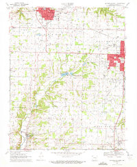
1970 Map of Bentonville South
USGS Topo · Published 1972About this map
Bentonville and Rogers dominate the northern portion of this landscape, showing the suburban expansion of these Northwest Arkansas hubs as they appeared in 1970. The corridor between these growing centers is marked by a mix of civic infrastructure and agricultural remnants, from the Bentonville Municipal Airport and Benton County Memorial Gardens to established family landmarks like Dodson Cem. Further south, the map reveals a more rural character across townships like Osage and Colville, where small community nodes are centered around Mt Hebron Ch and Oakley Chapel.
Find a feature on this map
59 named features on this map. Tap any name to fly to it.
Don’t see what you’re looking for? This feature index may not catch every label — zoom into the map to look around manually.
Map Details
Editions of this 1970 Bentonville South Map
3 editions found
Other maps of this area

1899 · Fayetteville
USGS Topo · 1:125,000

1901 · Fayetteville
USGS Topo · 1:125,000

1904 · Fayetteville
USGS Topo · 1:125,000

1954 · Tulsa
USGS Topo · 1:250,000

1958 · Sonora
USGS Topo · 1:24,000

1958 · Rogers
USGS Topo · 1:24,000

1958 · Pea Ridge
USGS Topo · 1:24,000

1958 · Tulsa
USGS Topo · 1:250,000

1963 · Tulsa
USGS Topo · 1:250,000

1970 · Robinson
USGS Topo · 1:24,000