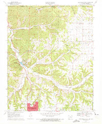
1970 Map of Bentonville North
USGS Topo · Published 1972About this map
Bentonville serves as the southern anchor of this 1970s survey, appearing at a pivotal moment of residential expansion as the city limits reach toward the hills of the Osage and Esculapia districts. The landscape to the north is defined by the winding course of Little Sugar Creek and its many tributaries, including Spanker Creek and Brush Creek. To the west, the growing community of Bella Vista centers around Bella Vista Lake and the nearby Wonderland Cave.
Find a feature on this map
47 named features on this map. Tap any name to fly to it.
Don’t see what you’re looking for? This feature index may not catch every label — zoom into the map to look around manually.
Map Details
Editions of this 1970 Bentonville North Map
4 editions found
Other maps of this area

1899 · Fayetteville
USGS Topo · 1:125,000

1901 · Fayetteville
USGS Topo · 1:125,000

1904 · Fayetteville
USGS Topo · 1:125,000

1940 · Noel
USGS Topo · 1:62,500

1941 · Rocky Comfort
USGS Topo · 1:62,500

1943 · Noel
USGS Topo · 1:62,500

1943 · Rocky Comfort
USGS Topo · 1:62,500

1954 · Tulsa
USGS Topo · 1:250,000

1958 · Rogers
USGS Topo · 1:24,000

1958 · Pea Ridge
USGS Topo · 1:24,000