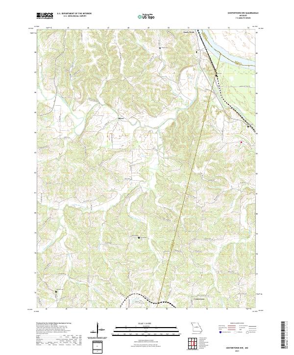
2021 Map of Centertown NW
USGS Topo · Published 2021About this map
Missouri River frontage and the convergence of Moniteau and Cole counties define this portion of central Missouri. The landscape is deeply etched by a network of drainage systems including Moniteau Creek, Little Moniteau Cr, and Haldiman Br, which carve through the terrain south of Sandy Hook. These waterways historically dictated the placement of early roads and small rural clusters like Bacon, which sits near the headwaters of several unnamed tributaries.
Find a feature on this map
70 named features on this map. Tap any name to fly to it.
Don’t see what you’re looking for? This feature index may not catch every label — zoom into the map to look around manually.
Map Details
Editions of this 2021 Centertown NW Map
This is the sole edition of this map. No revisions or reprints were ever made.
Other maps of this area

1886 · Jefferson City
USGS Topo · 1:125,000

1888 · Boonville
USGS Topo · 1:125,000

1894 · Jefferson City
USGS Topo · 1:125,000

1947 · Jefferson City
USGS Topo · 1:250,000

1948 · Centertown
USGS Topo · 1:62,500

1948 · Columbia
USGS Topo · 1:62,500
1949 · Centertown
USGS Topo · 1:62,500

1950 · Columbia
USGS Topo · 1:62,500

1951 · California South
USGS Topo · 1:24,000
1952 · Prairie Home
USGS Topo · 1:24,000