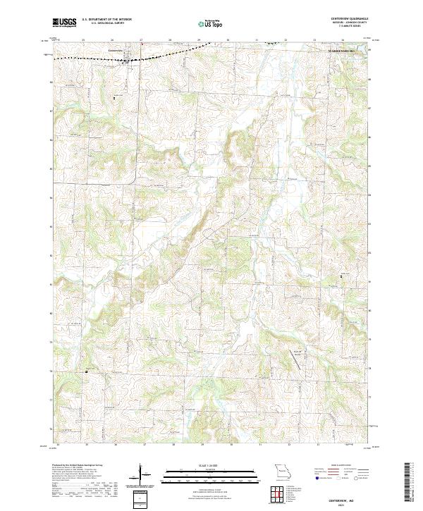
2021 Map of Centerview
USGS Topo · Published 2021About this map
Centerview serves as the focal point of this Johnson County landscape, situated west of the expanding reach of Warrensburg. The terrain is defined by a dense network of tributaries, including the W Fork Post Oak Cr and Bradley Br, which carve through the rural countryside. These watercourses historically dictated the placement of early homesteads and family burial grounds such as Sluder Cem and Pisgah Cem.
Find a feature on this map
38 named features on this map. Tap any name to fly to it.
Don’t see what you’re looking for? This feature index may not catch every label — zoom into the map to look around manually.
Map Details
Editions of this 2021 Centerview Map
This is the sole edition of this map. No revisions or reprints were ever made.
Other maps of this area

1885 · Warrensburg
USGS Topo · 1:125,000

1887 · Warrensburg
USGS Topo · 1:125,000

1894 · Warrensburg
USGS Topo · 1:125,000

1917 · Knobnoster
USGS Topo · 1:62,500

1947 · Jefferson City
USGS Topo · 1:250,000

1954 · Jefferson City
USGS Topo · 1:250,000

1954 · Centerview
USGS Topo · 1:24,000
1954 · Holden
USGS Topo · 1:24,000
1955 · Leeton
USGS Topo · 1:24,000

1955 · Cornelia
USGS Topo · 1:24,000