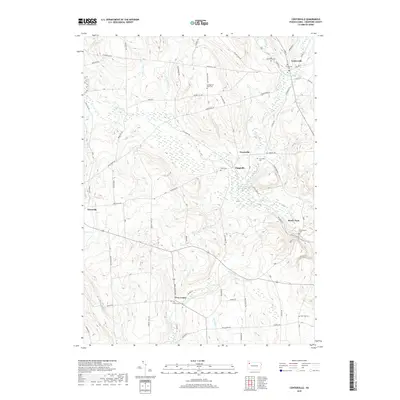
2019 Map of Centerville
USGS Topo · Published 2019About this map
Centerville and its surrounding rural landscapes in Crawford County are defined by a complex network of waterways, including the East Branch Oil Creek and the headwaters of Muddy Creek. The area is dotted with small settlements such as Tryonville, Clappville, and Troy Center, each serving as a focal point for the surrounding farms and woodlots. The map reveals a high density of community burial grounds, from the Sunnyside Cem near the northern border to the East Troy Cem in the southeast, providing a significant resource for genealogical research in this part of Pennsylvania.
Find a feature on this map
84 named features on this map. Tap any name to fly to it.
Don’t see what you’re looking for? This feature index may not catch every label — zoom into the map to look around manually.
Map Details
Editions of this 2019 Centerville Map
This is the sole edition of this map. No revisions or reprints were ever made.
Other maps of this area

1927 · Townville
USGS Topo · 1:48,000

1927 · Titusville
USGS Topo · 1:62,500

1929 · Corry
USGS Topo · 1:48,000

1929 · Union City
USGS Topo · 1:62,500

1932 · Corry
USGS Topo · 1:62,500

1932 · Townville
USGS Topo · 1:62,500

1932 · Union City
USGS Topo · 1:62,500

1933 · Titusville
USGS Topo · 1:62,500

1945 · Townville
USGS Topo · 1:62,500

1957 · Warren
USGS Topo · 1:250,000