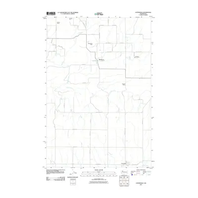
2011 Map of Centerville
USGS Topo · Published 2011About this map
Centerville and Blockhouse anchor this 2011 survey of the Klickitat Valley, where the landscape is defined by the transition from open range to the distinct volcanic profiles of the High Cascades' eastern slope. The map details a rural geography structured around water resources, from the Little Klickitat River and Swale Creek to the industrial operations at the Goldendale Trout Hatchery. Local land management and family history are reflected in the dense network of ranch and access roads, including Harris Ranch Rd, Olson Rd, and Schilling Loop Rd. High ground like Blockhouse Butte overlooks a terrain where agriculture meets the hydrology of Mill Creek and the Schilling Dam. This record documents the rural character of Klickitat County, showing the persistent settlement patterns and modern ranching infrastructure that define this part of the Washington territory.
Find a feature on this map
50 named features on this map. Tap any name to fly to it.
Don’t see what you’re looking for? This feature index may not catch every label — zoom into the map to look around manually.
Map Details
Editions of this 2011 Centerville Map
This is the sole edition of this map. No revisions or reprints were ever made.
Other maps of this area

1934 · The Dalles
USGS Topo · 1:125,000

1953 · The Dalles
USGS Topo · 1:250,000

1956 · The Dalles
USGS Topo · 1:250,000

1957 · The Dalles
USGS Topo · 1:250,000

1957 · Klickitat
USGS Topo · 1:62,500

1957 · Goldendale
USGS Topo · 1:62,500

1957 · The Dalles
USGS Topo · 1:62,500

1957 · Wishram
USGS Topo · 1:62,500

1974 · Stacker Butte
USGS Topo · 1:24,000
1977 · Wishram
USGS Topo · 1:24,000