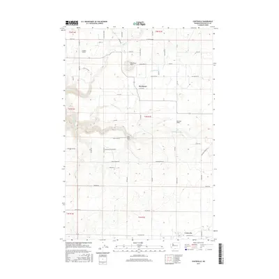
2017 Map of Centerville
USGS Topo · Published 2017About this map
Blockhouse Butte stands as a prominent landmark overlooking the agricultural expanses of the Klickitat Valley in this modern-era survey. The landscape is defined by its rural road network, which often bears the names of local families and ranches, such as Harris Ranch Rd and Ihrig Goree RD. To the north, the terrain transitions into the Crofton Prairie, while the southern reaches are anchored by the small community of Centerville. Water is a critical component of the local geography, with the Little Klickitat River and its tributaries, including Blockhouse Cr and Mill Cr, cutting through the valley floor. Aviation history in the area is represented by the Piper Canyon Airport, located near the river's bend. This map effectively documents the persistent rural character of Klickitat County, where development remains concentrated along established routes like Centerville Hwy.
Find a feature on this map
56 named features on this map. Tap any name to fly to it.
Don’t see what you’re looking for? This feature index may not catch every label — zoom into the map to look around manually.
Map Details
Editions of this 2017 Centerville Map
This is the sole edition of this map. No revisions or reprints were ever made.
Other maps of this area

1934 · The Dalles
USGS Topo · 1:125,000

1953 · The Dalles
USGS Topo · 1:250,000

1956 · The Dalles
USGS Topo · 1:250,000

1957 · The Dalles
USGS Topo · 1:250,000

1957 · Klickitat
USGS Topo · 1:62,500

1957 · Goldendale
USGS Topo · 1:62,500

1957 · The Dalles
USGS Topo · 1:62,500

1957 · Wishram
USGS Topo · 1:62,500

1974 · Stacker Butte
USGS Topo · 1:24,000
1977 · Wishram
USGS Topo · 1:24,000