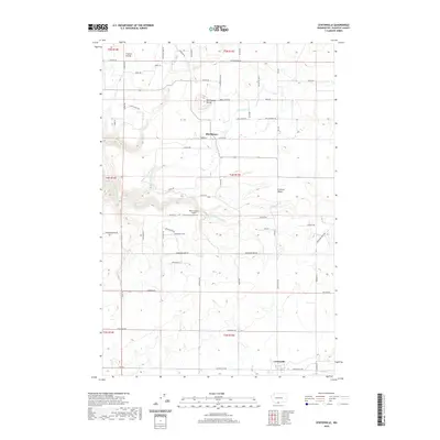
2020 Map of Centerville
USGS Topo · Published 2020About this map
Klickitat Valley agricultural lands and the high plateaus of south-central Washington are meticulously documented in this contemporary survey. The settlement of Centerville anchors the southern portion of the map, situated near the seasonal drainage of Swale Cr, while the community of Blockhouse and the prominent Blockhouse Butte define the central landscape. The terrain transitions from the open stretches of Crofton Prairie in the northwest down toward the Little Klickitat River drainage system.
Find a feature on this map
62 named features on this map. Tap any name to fly to it.
Don’t see what you’re looking for? This feature index may not catch every label — zoom into the map to look around manually.
Map Details
Editions of this 2020 Centerville Map
This is the sole edition of this map. No revisions or reprints were ever made.
Other maps of this area

1934 · The Dalles
USGS Topo · 1:125,000

1953 · The Dalles
USGS Topo · 1:250,000

1956 · The Dalles
USGS Topo · 1:250,000

1957 · The Dalles
USGS Topo · 1:250,000

1957 · Klickitat
USGS Topo · 1:62,500

1957 · Goldendale
USGS Topo · 1:62,500

1957 · The Dalles
USGS Topo · 1:62,500

1957 · Wishram
USGS Topo · 1:62,500

1974 · Stacker Butte
USGS Topo · 1:24,000
1977 · Wishram
USGS Topo · 1:24,000