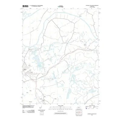
2010 Map of Central City East
USGS Topo · Published 2010About this map
Green River meanders across the northern portion of this quadrangle, defining the landscape between Central City and Ceralvo. The area is characterized by a dense concentration of burial grounds, providing significant resources for genealogical research, including Rose Hill Cemetery, Fairmont Cemetery, and Miller Cemetery. The presence of several industrial thoroughfares such as Green River Haul Rd, Monsanto Haul Rd, and River Haul Rd highlights the local infrastructure designed for transport between the river and nearby settlements. Small communities like Martwick, Cleaton, and Stringtown are dispersed throughout the region, connected by a network of local roads including Rose School Rd and Drakes School Rd, illustrating the rural settlement patterns typical of this part of Muhlenberg County in the early twenty-first century.
Find a feature on this map
38 named features on this map. Tap any name to fly to it.
Don’t see what you’re looking for? This feature index may not catch every label — zoom into the map to look around manually.
Map Details
Editions of this 2010 Central City East Map
This is the sole edition of this map. No revisions or reprints were ever made.
Other maps of this area

1909 · Hartford
USGS Topo · 1:62,500

1909 · Central City
USGS Topo · 1:62,500

1911 · Drakesboro
USGS Topo · 1:48,000

1911 · Dunmor
USGS Topo · 1:48,000

1913 · Drakesboro
USGS Topo · 1:62,500

1914 · Dunmor
USGS Topo · 1:62,500

1952 · Equality
USGS Topo · 1:24,000

1952 · Livermore
USGS Topo · 1:24,000

1952 · Greenville
USGS Topo · 1:24,000

1953 · Drakesboro
USGS Topo · 1:24,000