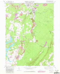
1971 Map of Central City
USGS Topo · Published 1982About this map
Extensive industrial and recreational landscapes define this Somerset County region during the early 1970s. The northern sector is dominated by the borough of Central City and the neighboring settlement of Cairnbrook, where the local economy is anchored by coal extraction and processing infrastructure. Evidence of this activity is visible in the numerous Strip Mines, a Tipple, and an intricate network of Conrail lines servicing the various mine sites. This heavy industry stands in sharp contrast to the developing leisure areas to the south, including the Indian Lake residential community, which features a Golf Course and the Indian Lake Airport. To the east, the terrain rises sharply toward the Allegheny front, protected within State Game Lands No 228. This map captures a transition point for the area, illustrating how historic coal towns persisted alongside newer highland retreats and conservation lands like those near Fraziers Pass.
Find a feature on this map
48 named features on this map. Tap any name to fly to it.
Don’t see what you’re looking for? This feature index may not catch every label — zoom into the map to look around manually.
Map Details
Editions of this 1971 Central City Map
2 editions found
Other maps of this area

1908 · Bedford
USGS Topo · 1:62,500

1910 · Bedford
USGS Topo · 1:62,500

1914 · Windber
USGS Topo · 1:62,500

1916 · Windber
USGS Topo · 1:62,500

1923 · Berlin
USGS Topo · 1:48,000

1927 · Hyndman
USGS Topo · 1:62,500

1929 · Berlin
USGS Topo · 1:62,500

1931 · Hyndman
USGS Topo · 1:62,500

1944 · Hyndman
USGS Topo · 1:62,500

1944 · Windber
USGS Topo · 1:62,500