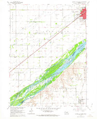
1962 Map of Central City West
USGS Topo · Published 1963About this map
The Platte River dominates this mid-century Nebraska landscape, its braided channels creating a complex of sandbars and wetlands including Bushes Island. The terrain is shaped by the parallel flow of Prairie Creek to the north and the heavy presence of the Union Pacific railroad, which dictates the layout of Central City. This urban center features a concentration of infrastructure including the Central City Airport, a Fairground, and local industry represented by Gravel Pits along the eastern edge.
Find a feature on this map
30 named features on this map. Tap any name to fly to it.
Don’t see what you’re looking for? This feature index may not catch every label — zoom into the map to look around manually.
Map Details
Editions of this 1962 Central City West Map
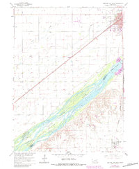
2 editions found
Other maps of this area

1896 · Stromsburg
USGS Topo · 1:125,000

1898 · York
USGS Topo · 1:125,000

1898 · Grand Island
USGS Topo · 1:125,000

1899 · St. Paul
USGS Topo · 1:125,000

1899 · York
USGS Topo · 1:125,000

1955 · Broken Bow
USGS Topo · 1:250,000

1955 · Fremont
USGS Topo · 1:250,000

1955 · Lincoln
USGS Topo · 1:250,000

1955 · Grand Island
USGS Topo · 1:250,000

1956 · Broken Bow
USGS Topo · 1:250,000