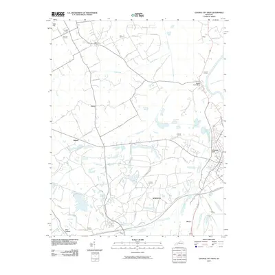
2010 Map of Central City West
USGS Topo · Published 2010About this map
Cypress Creek and its many tributaries, including Little Cypress Creek and Muddy Fork, dominate the drainage of this Muhlenberg County landscape just west of Central City. The terrain is marked by a network of rural settlements like Gishton, Bremen, and Midland, connected by winding roads such as Buttermilk Rd and Lynn City Rd. Along the eastern edge, the Green River flows past South Carrollton and Mogg, where the presence of a large power plant indicates the industrial importance of the river corridor. Genealogists will find a significant concentration of family and community burial grounds throughout the area, including Bethlehem Cemetery, Scott Cemetery, and Gish Cemetery. The southern portion of the map is bisected by the Wendell H Ford Western Ky Pkwy, illustrating the modern transportation infrastructure that skirts the older centers of Morehead and Mercer.
Find a feature on this map
47 named features on this map. Tap any name to fly to it.
Don’t see what you’re looking for? This feature index may not catch every label — zoom into the map to look around manually.
Map Details
Editions of this 2010 Central City West Map
This is the sole edition of this map. No revisions or reprints were ever made.
Other maps of this area

1909 · Madisonville
USGS Topo · 1:62,500

1909 · Central City
USGS Topo · 1:62,500

1911 · Drakesboro
USGS Topo · 1:48,000

1912 · Nortonville
USGS Topo · 1:62,500

1913 · Drakesboro
USGS Topo · 1:62,500

1952 · Equality
USGS Topo · 1:24,000

1952 · Livermore
USGS Topo · 1:24,000

1952 · Sacramento
USGS Topo · 1:24,000

1952 · Greenville
USGS Topo · 1:24,000

1953 · Drakesboro
USGS Topo · 1:24,000