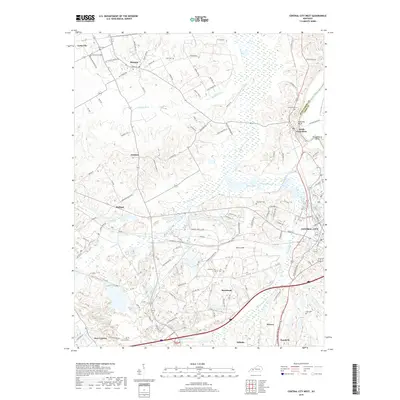
2019 Map of Central City West
USGS Topo · Published 2019About this map
Bremen and South Carrollton anchor this western portion of Muhlenberg County along the Green River, illustrating a landscape shaped by coal mining history and river transport. The topography is defined by the winding course of the Green River at Shrewsbury Bend and the drainage of Muddy Fork and Cypress Cr. Numerous small cemeteries such as Gish Cem, Bethlehem Cem, and Evergreen Cem are scattered throughout, providing critical touchpoints for genealogical research in the rural areas between Central City and Lynn City. The map reveals a transition from the structured street grids of Powderly and Morehead in the south to the broad wetlands and ridges that characterize the county's interior. Notable landforms like Fentress Bluff overlook the river, marking the natural boundary shared with Ohio County.
Find a feature on this map
107 named features on this map. Tap any name to fly to it.
Don’t see what you’re looking for? This feature index may not catch every label — zoom into the map to look around manually.
Map Details
Editions of this 2019 Central City West Map
This is the sole edition of this map. No revisions or reprints were ever made.
Other maps of this area

1909 · Madisonville
USGS Topo · 1:62,500

1909 · Central City
USGS Topo · 1:62,500

1911 · Drakesboro
USGS Topo · 1:48,000

1912 · Nortonville
USGS Topo · 1:62,500

1913 · Drakesboro
USGS Topo · 1:62,500

1952 · Equality
USGS Topo · 1:24,000

1952 · Livermore
USGS Topo · 1:24,000

1952 · Sacramento
USGS Topo · 1:24,000

1952 · Greenville
USGS Topo · 1:24,000

1953 · Drakesboro
USGS Topo · 1:24,000