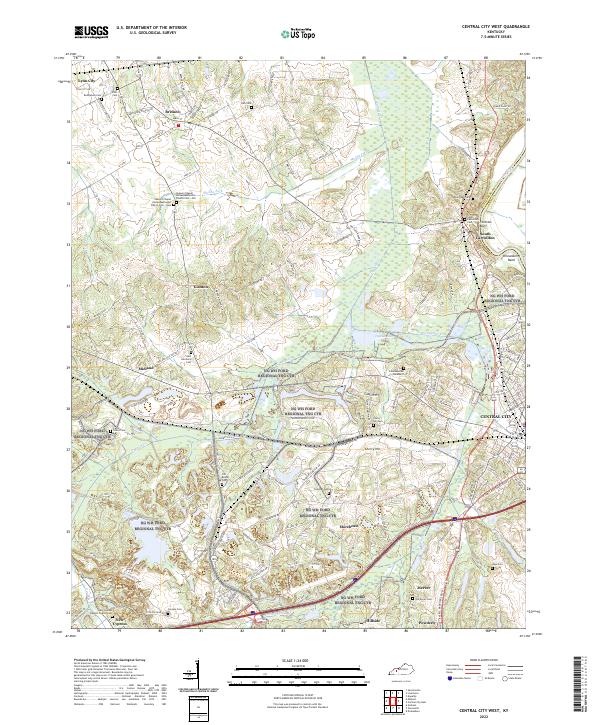
2022 Map of Central City West
USGS Topo · Published 2022About this map
Central City and the surrounding coal-country landscape of Muhlenberg County are defined by a complex network of rural roads and watercourses. The map documents the eastern boundary along the Green River, where Fentress Bluff and Shrewsbury Bend create a sharp geographic contrast to the inland creek basins. Local history is deeply etched into the terrain through numerous small cemeteries such as Bethlehem Cem, New Harmony Cem, and the dual sites of Shavers Chapel United Methodist Church Cem - Old and Shavers Chapel United Methodist Church Cem - New. This modern survey reveals the persistent settlement patterns of communities like Bremen, Midland, and South Carrollton, showing how residential clusters remain tied to historical corridors like Bethlehem Church Rd and Buttermilk Rd even as industrial features like Power Plant Rd signal modern infrastructure.
Find a feature on this map
150 named features on this map. Tap any name to fly to it.
Don’t see what you’re looking for? This feature index may not catch every label — zoom into the map to look around manually.
Map Details
Editions of this 2022 Central City West Map
This is the sole edition of this map. No revisions or reprints were ever made.
Other maps of this area

1909 · Madisonville
USGS Topo · 1:62,500

1909 · Central City
USGS Topo · 1:62,500

1911 · Drakesboro
USGS Topo · 1:48,000

1912 · Nortonville
USGS Topo · 1:62,500

1913 · Drakesboro
USGS Topo · 1:62,500

1952 · Equality
USGS Topo · 1:24,000

1952 · Livermore
USGS Topo · 1:24,000

1952 · Sacramento
USGS Topo · 1:24,000

1952 · Greenville
USGS Topo · 1:24,000

1953 · Drakesboro
USGS Topo · 1:24,000