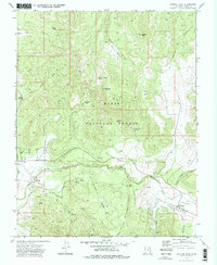
1972 Map of Central East
USGS Topo · Published 1977About this map
Pine Valley and the small settlement of Central anchor the high-elevation landscape of Washington County in this early 1970s topographic study. Situated within the Dixie National Forest, the region is defined by its complex network of seasonal water sources and rugged topography, including prominent landmarks like Harrison Peak and Atchinson Mountain. The presence of several resource-extraction sites, such as a Cinder Pit near the Santa Clara River and a Gravel Pit in the southeast, points to the local industrial activity of the era.
Find a feature on this map
72 named features on this map. Tap any name to fly to it.
Don’t see what you’re looking for? This feature index may not catch every label — zoom into the map to look around manually.
Map Details
Editions of this 1972 Central East Map
2 editions found
Other maps of this area

1885 · St. George
USGS Topo · 1:250,000

1891 · St. George
USGS Topo · 1:250,000

1950 · Iron Mountain
USGS Topo · 1:62,500

1950 · Page Ranch
USGS Topo · 1:24,000

1951 · Page Ranch
USGS Topo · 1:24,000

1953 · Cedar City
USGS Topo · 1:250,000

1957 · New Harmony
USGS Topo · 1:62,500

1958 · Cedar City
USGS Topo · 1:250,000

1962 · Cedar City
USGS Topo · 1:250,000
1972 · Pinto
USGS Topo · 1:24,000