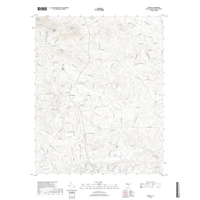
2019 Map of Central
USGS Topo · Published 2019About this map
Love Valley serves as a central hub for this portion of Iredell County, situated among the peaks of Fox Mtn and McHargue Mtn. The landscape is defined by a dense network of minor waterways including Olin Cr, Tuckers Cr, and Little Rocky Cr, all feeding toward the southern boundary of the map. This area shows a transition from the elevated northern terrain down to the broader valley of the South Yadkin River. Local infrastructure is characterized by numerous family-named farm lanes and rural routes like Wilson Farm Rd and Bowles Farm Rd, indicating a persistent agricultural land-use pattern. Transportation and recreation are highlighted by the Raeford Rhyne Airpark and the private waters of Windy Hills Acres Lake, which stand out against the otherwise rural, stream-dissected topography of this North Carolina Piedmont region.
Find a feature on this map
119 named features on this map. Tap any name to fly to it.
Don’t see what you’re looking for? This feature index may not catch every label — zoom into the map to look around manually.
Map Details
Editions of this 2019 Central Map
This is the sole edition of this map. No revisions or reprints were ever made.
Other maps of this area

1889 · Wilkesboro
USGS Topo · 1:125,000

1891 · Wilkesboro
USGS Topo · 1:125,000

1891 · Yadkinville
USGS Topo · 1:125,000

1893 · Statesville
USGS Topo · 1:125,000

1893 · Yadkinville
USGS Topo · 1:125,000

1895 · Hickory
USGS Topo · 1:125,000

1953 · Charlotte
USGS Topo · 1:250,000

1953 · Winston-Salem
USGS Topo · 1:250,000

1954 · Charlotte
USGS Topo · 1:250,000

1955 · Winston-Salem
USGS Topo · 1:250,000