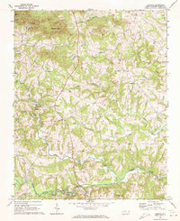
1969 Map of Central
USGS Topo · Published 1972About this map
The South Yadkin River forms the southern boundary of this Iredell County landscape, where the terrain transitions from the elevations of McHargue Mtn and Fox Mtn down toward the winding creek valleys. In the late 1960s, rural life here centered on a dense network of community landmarks, particularly the numerous country churches like Keaton Grove Ch, Damascus Ch, and Rocky Hill Ch. The settlement of Love Valley sits in the northwest, while the community of Central is anchored by the Central Sch.
Find a feature on this map
31 named features on this map. Tap any name to fly to it.
Don’t see what you’re looking for? This feature index may not catch every label — zoom into the map to look around manually.
Map Details
Editions of this 1969 Central Map
This is the sole edition of this map. No revisions or reprints were ever made.
Other maps of this area

1889 · Wilkesboro
USGS Topo · 1:125,000

1891 · Wilkesboro
USGS Topo · 1:125,000

1891 · Yadkinville
USGS Topo · 1:125,000

1893 · Statesville
USGS Topo · 1:125,000

1893 · Yadkinville
USGS Topo · 1:125,000

1895 · Hickory
USGS Topo · 1:125,000

1953 · Charlotte
USGS Topo · 1:250,000

1953 · Winston-Salem
USGS Topo · 1:250,000

1954 · Charlotte
USGS Topo · 1:250,000

1955 · Winston-Salem
USGS Topo · 1:250,000