1950 Map of Central La Plata SE
USGS Topo · Published 1950About this map
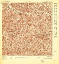
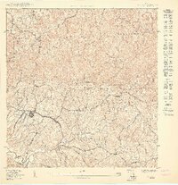
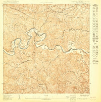
The Río Grande de Añasco carves a deep, serpentine path through this interior landscape, marking the complex municipal boundaries of Moca, San Sebastián, Añasco, and Las Marías. Surveyed just after the war, the map reveals a rural economy centered on the high ridges and steep valleys of the Alto Sano and Furnias districts. The settlement pattern is defined by family-named landmarks and local institutions, such as the Escuela Segunda Unidad de Añones and the Iglesia de Dios (Pentecostal), which served the dispersed population of Añones.
Find a feature on this map
38 named features on this map. Tap any name to fly to it.
Don’t see what you’re looking for? This feature index may not catch every label — zoom into the map to look around manually.
Map Details
Editions of this 1950 Central La Plata SE Map
This is the sole edition of this map. No revisions or reprints were ever made.
Historical Maps of Moca Through Time
3 maps found